25-year Evolution of Early Warning Systems in Central America
The Mitch+25 Forum analysed progress in early warning systems in Central America since Mitch, historically the most catastrophic hurricane in the region.
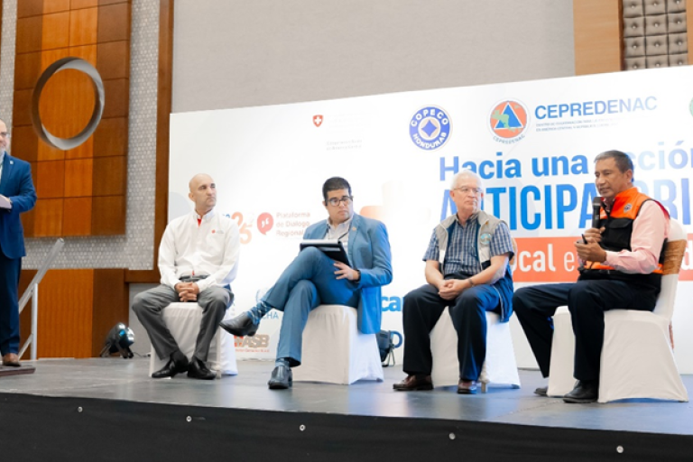
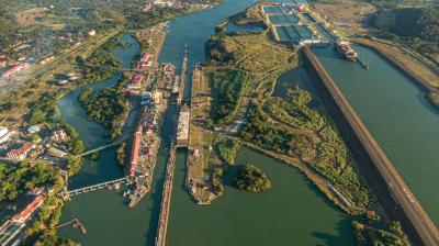
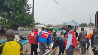
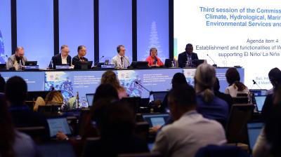
The Mitch+25 Forum, organized by CEPREDENAC (Centro de Coordinación para la Prevención de los Desastres Naturales en América Central), in Honduras from 30 October to 2 November, analysed the progress in early warning systems in Central America since Mitch, historically the most catastrophic hurricane in the region. At the event, WMO and the United Nations Office for Disaster Risk Reduction (UNDRR) led a panel discussion that looked at points of reference to measure the progress: Mitch (1995) and Eta/Iota 2020.
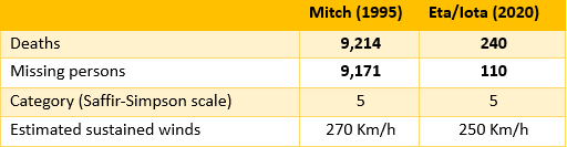
Two senior meteorologists from Honduras and Guatemala, who staffed their National Meteorological and Hydrological Services (NMHSs) during Mitch, a Disaster Risk Management authority of Panama and an expert of the Costa Rican Red Cross formed the panel. They noted that the reduction in deaths and missing persons from 1995 to 2020 was quite remarkable and attributed the change to several factors.
Disaster risk knowledge increased: more information is available on exposure, there is more systematic data gathering and there are more disasters databases such as DESINVENTAR. This change occurred at both the regional and national level.
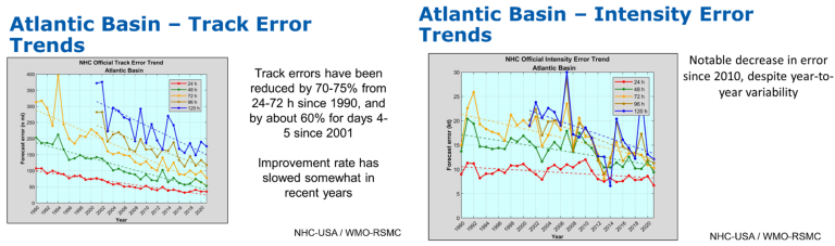
Better detection, observations, monitoring, analysis and forecasting of hazards: operational coordination has improved in the region through the WMO Regional Association IV Hurricane Committee, the advancement of the WMO Integrated Global Observing System (WIGOS), the WMO Integrated Processing and Prediction System (WIPPS), the WMO Integrated Information System, the development of the Central American Flash Flood Guidance System (CAFFGS) and radar integration in Central America as well as other factors. This has brought a substantial improvement in the prediction of the intensity and trajectory of tropical cyclones. Information on situations in flux cascade down smoothly from the global, regional to national level.
Warning dissemination and communication: The evolution of communication technology has enabled multiple channels of dissemination; however, it is the increasing public trust in warning messages and the timeliness of their delivery that have made the biggest difference.
Preparedness to respond: All Central American countries have developed protocols and manuals for Early Warning Systems. There has also been greater inclusion of vulnerable groups in preparedness efforts as is evidenced in preparation and response plans and execution.
Governance: Most of Central American countries have established National Emergency Committees and legal frameworks for integral disaster risk management.
The discussions also underlined several remaining challenges to further improve EWS:
- The recruitment and retention of qualified personnel is increasingly difficult for NMHSs due to limited financial resources, which also hamper their ability to maintain national observing networks and improve data management and prediction systems
- Persistent barriers to the flow information are delaying early response at the local level
- The multiplicity of information sources during hurricanes generate confusion and, on numerous occasions, affects the agility of decision-making in the ground
- Public policies on the funding of the institutions responsible for EWSs need to be strengthened
- Representation and active participation of local communities needs to be consolidated in inclusive approach that will strengthen the community perspective in all processes.
The conveners of Mitch+25 and the organizers of the panel will continue to work with all the regional stakeholders to tackle these challenges and ensure that there are Early Warnings for All.